

1940 US Census for Nevada County Arkansas

There were 23 enumeration districts (EDs) in Nevada County in 1940. Each of the four wards in City of Prescott was an ED, the city of Emmet an ED, and the rural townships were in either one or two EDs. Beginning April 1, 1940, an enumerator went from building to building, recording the names of each person and their relationship to the head of household.
Enumerators created almost 600 pages of schedules in Nevada County. The listing on this page has links to images for each page of the schedules, along with links to the images of the official Census maps for Nevada County and Prescott and the images of the descriptions of the ED. Each high-resolution image is about five megabytes.
The Museum is creating a searchable name index of the Census. The status of indexing is shown on the last line of each ED's information.
The 1940 Census was put on microfilm in mid-century. In the past few years, the microfilm was digitized into JPG images. This is the first Census released on the internet. It was released Monday April 2, 2012, the earliest allowed by law, 72 years after Census Day 1940. The public domain images were downloaded from 1940Census.Archives.Gov and on that site researchers will find a tremendous amount of information about the Census and how to use it. This is also the place to begin a search for an areas other than Nevada County. Begin with the state and city/county, then use "Maps" or "Descriptions" to determine the ED number, and finally choose "Census Schedules" for the ED. It's possible to browse images page-by-page, download one page, or download all the pages/images in an ED to a singe ZIP file.
Search Nevada County Arkansas Census Records

- Maps, Descriptions, Notes
- Description 1
- Description 2
- Description 3
- Description 4
- Map Nevada 1 (North portion) (North on Left Side)
- Map Nevada 2 (SouthWest portion) (North on Left Side)
- Map Nevada 3 (NorthWest portion) (North on Left Side)
- Map Nevada 4 (SouthEast portion)
- Map Prescott
- NOTES
- Description 2
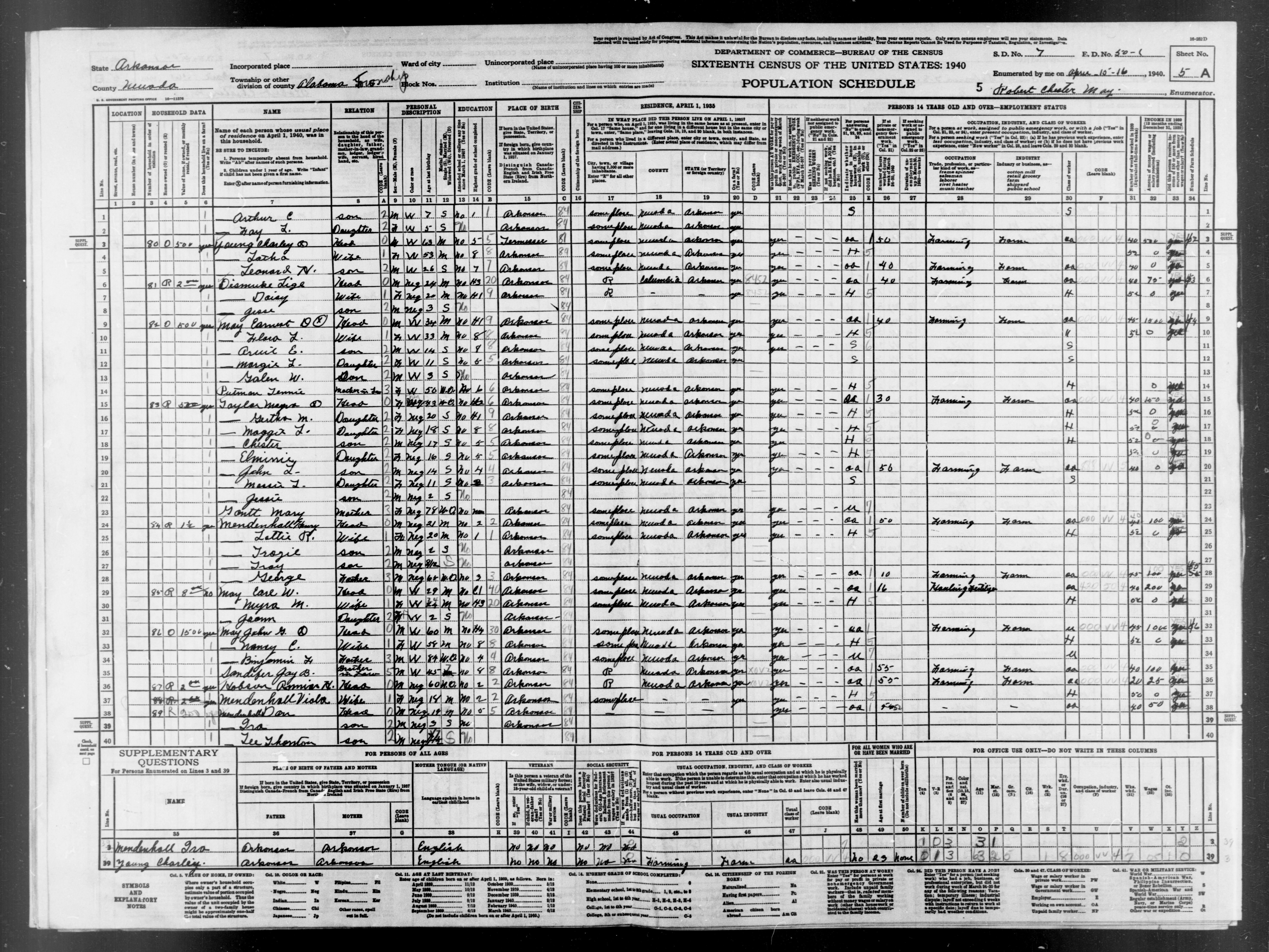
- Enumeration District 1 Alabama Township
- Description: Arkansas Enumeration District 50-1 Alabama township
- Enumerated in 1940 by: Robert Chester May
- 1940 Population: 948, 1930 Population: 1125, 1930 Farms: 361
- Images: 1 2 3 4 5 6 7 8 9 10 11 12 13 14 15 16 17 18 19 20 21 22 23 24
- Index Compiled By: Jerry McKelvy.
- Enumerated in 1940 by: Robert Chester May
- Enumeration District 2 Albany Township North
- Description: Arkansas Enumeration District 50-2 Albany township
- Boundaries: That part north of the township line between Townships 12 and 13, Ranges 22 and 23.
- Enumerated in 1940 by: Joe W. Ghormley
- 1940 Population: 797, 1930 Population: 870, 1930 Farms: 174
- Images: 1 2 3 4 5 6 7 8 9 10 11 12 13 14 15 16 17 18 19 20
- Index Compiled By: Barbara Woelzlein.
- Boundaries: That part north of the township line between Townships 12 and 13, Ranges 22 and 23.
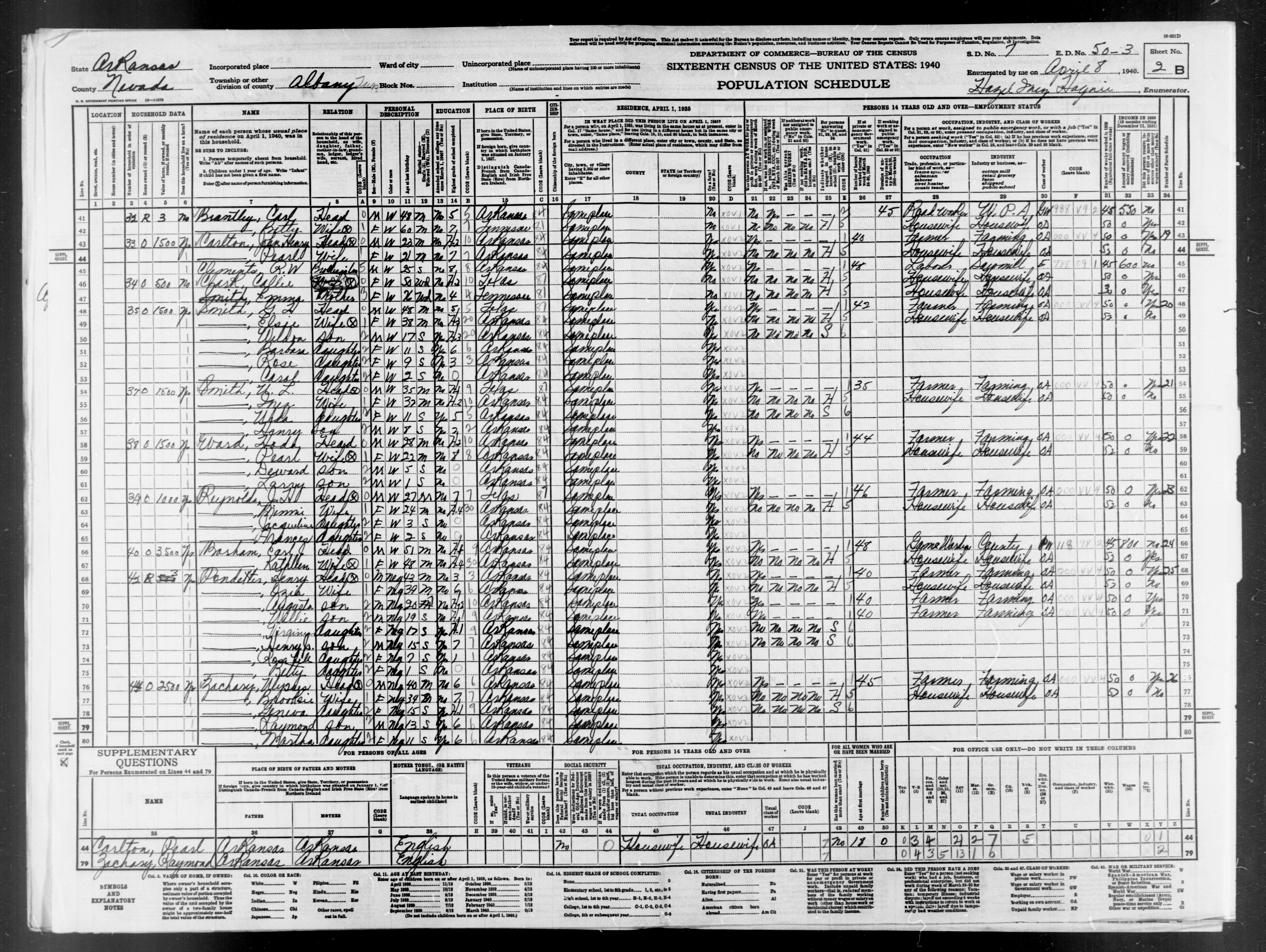
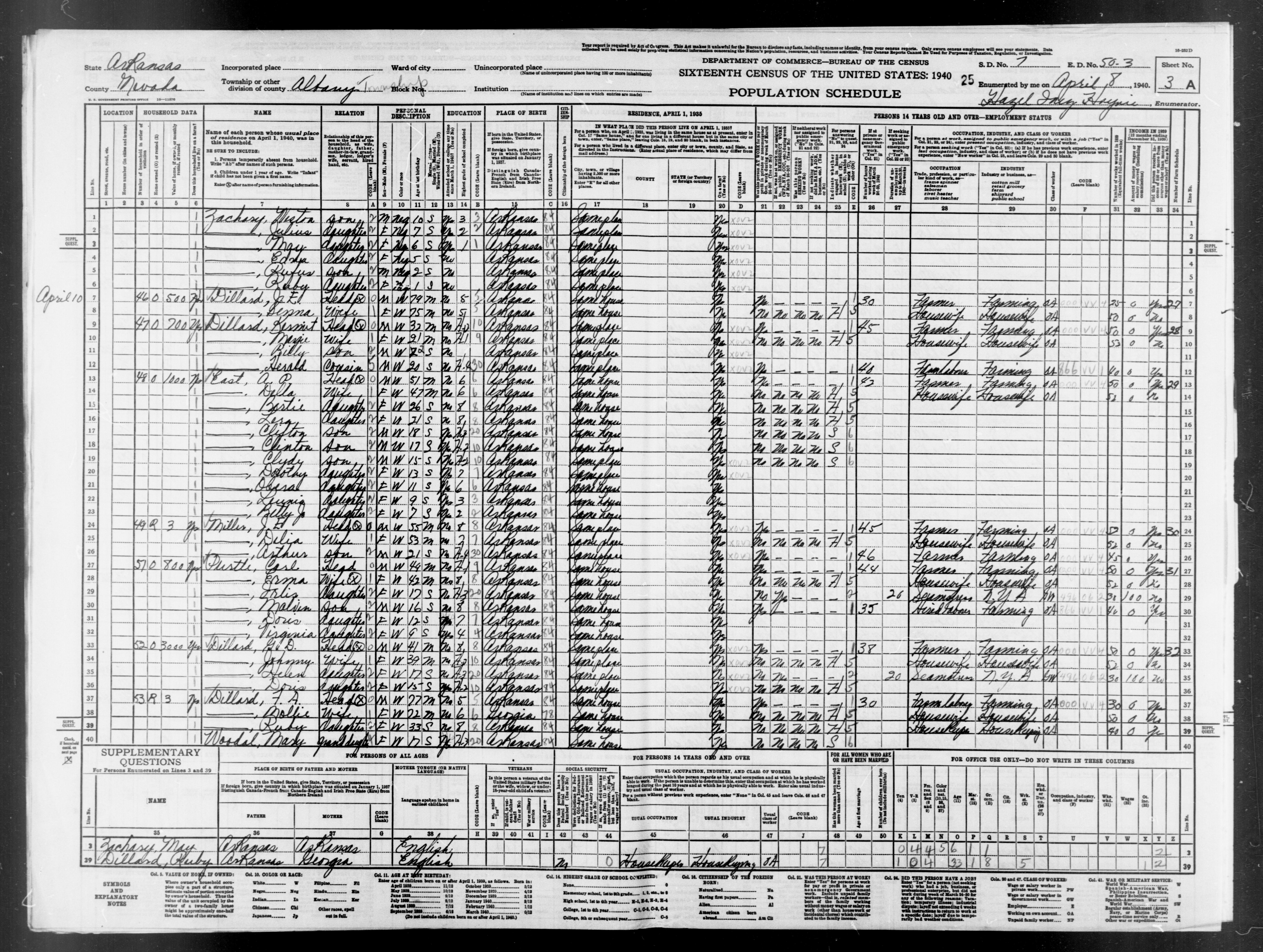
- Enumeration District 3 Albany Township South
- Description: Arkansas Enumeration District 50-3 Albany township
- Boundaries: That part south of the township line between Townships 12 and 13, Ranges 22 and 23.
- Enumerated in 1940 by: Hazel Inez Haynie
- 1940 Population: 670, 1930 Population: 882, 1930 Farms: 204
- Images: 1 2 3 4 5 6 7 8 9 10 11 12 13 14 15 16 17 18 19 20
- Index Compiled By: Barbara Woelzlein.
- Boundaries: That part south of the township line between Townships 12 and 13, Ranges 22 and 23.
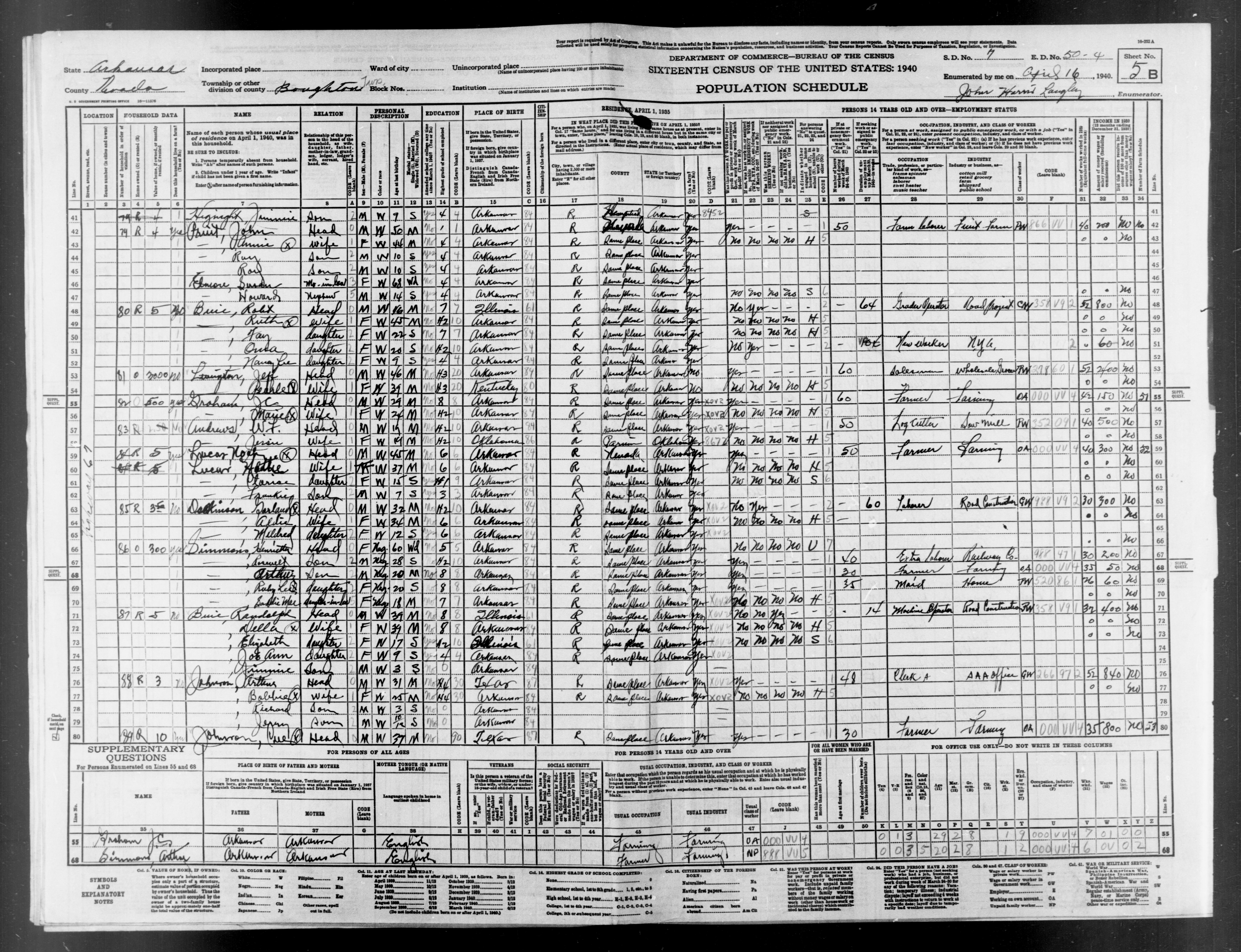
- Enumeration District 4 Boughton Township
- Description: Arkansas Enumeration District 50-4 Boughton township
- Boundaries: Show seperately Boughton (unincorporated).
- Enumerated in 1940 by: John Harris Langley
- 1940 Population: 903, 1930 Population: 1046, 1930 Farms: 209
- Images: 1 2 3 4 5 6 7 8 9 10 11 12 13 14 15 16 17 18 19 20 21 22 23 24 25 26
- Index Compiled By: Charlotte Woody.
- Boundaries: Show seperately Boughton (unincorporated).
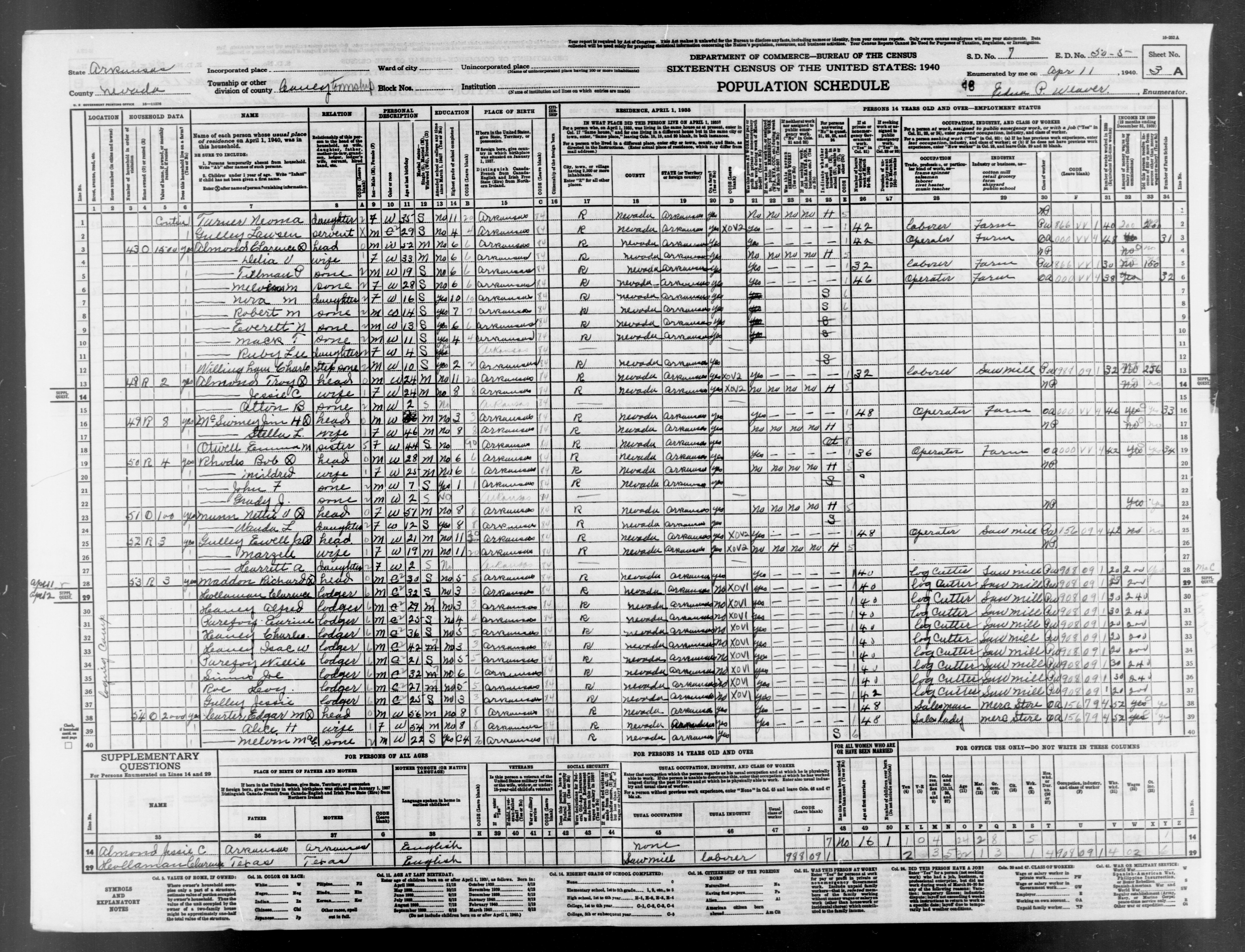
- Enumeration District 5 Caney Township North
- Description: Arkansas Enumeration District 50-5 Caney township
- Boundaries: That part in the North 1/2 of Township 13, Range 21. Show separately Cale (unincorporated).
- Enumerated in 1940 by: Edna P Weaver
- 1940 Population: 497, 1930 Population: 577, 1930 Farms: 87
- Images: 1 2 3 4 5 6 7 8 9 10 11 12 13 14
- Index Compiled By: Paulette Weaver.
- Boundaries: That part in the North 1/2 of Township 13, Range 21. Show separately Cale (unincorporated).
- Enumeration District 6 Caney Township South
- Description: Arkansas Enumeration District 50-6 Caney township
- Boundaries: That part in the South 1/2 off Township 13, Range 21. Show separately Rosston (unincorporated).
- Enumerated in 1940 by: Walter S Owen
- 1940 Population: 893, 1930 Population: 568, 1930 Farms: 85
- Images: 1 2 3 4 5 6 7 8 9 10 11 12 13 14 15 16 17 18 19 20 21 22 23 24 25 26
- Index Compiled By: Danny Stewart.
- Boundaries: That part in the South 1/2 off Township 13, Range 21. Show separately Rosston (unincorporated).
- Enumeration District 7 Emmet
- Description: Arkansas Enumeration District 50-7 Emmet town.
- Enumerated in 1940 by: Mrs Denver Whitten
- 1940 Population: 465, 1930 Population: 387, 1930 Farms: 25
- Images: 1 2 3 4 5 6 7 8 9 10 11 12 13 14
- Index Compiled By: Yvonne Munn.
- Enumerated in 1940 by: Mrs Denver Whitten
- Enumeration District 8 Emmet Township
- Description: Arkansas Enumeration District 50-8 Emmet township
- Boundaries: That part outside Emmet town.
- Enumerated in 1940 by: Mrs Denver Whitten
- 1940 Population: 555, 1930 Population: 620, 1930 Farms: 120
- Images: 1 2 3 4 5 6 7 8 9 10 11 12 13 14
- Index Compiled By: Julie Lofurno.
- Boundaries: That part outside Emmet town.
- Enumeration District 9 Georgia Township
- Description: Arkansas Enumeration District 50-9 Georgia township.
- Enumerated in 1940 by: Spurgeon Goodloe Otwell
- 1940 Population: 651, 1930 Population: 675, 1930 Farms: 138
- Images: 1 2 3 4 5 6 7 8 9 10 11 12 13 14 15 16 17 18
- Index Compiled By: Jerry McKelvy.
- Enumerated in 1940 by: Spurgeon Goodloe Otwell
- Enumeration District 10 Jackson Township
- Description: Arkansas Enumeration District 50-10 Jackson township.
- Enumerated in 1940 by: Hildre J Griffith
- 1940 Population: 644, 1930 Population: 867, 1930 Farms: 172
- Images: 1 2 3 4 5 6 7 8 9 10 11 12 13 14 15 16 17 18
- Index Compiled By: Yvonne Munn.
- Enumerated in 1940 by: Hildre J Griffith
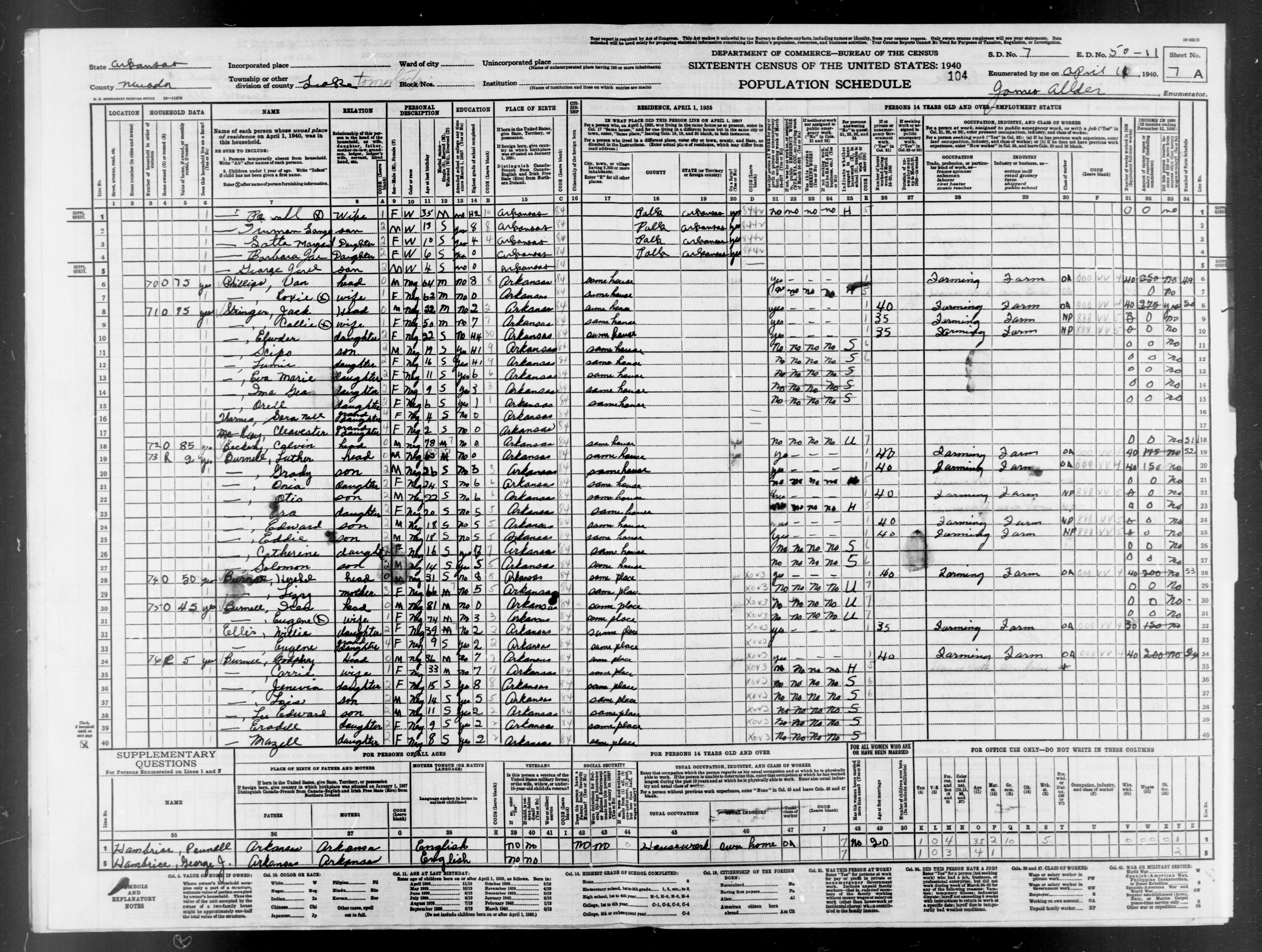
- Enumeration District 11 Leake Township
- Description: Arkansas Enumeration District 50-11 Leake township
- Boundaries: Show separately Glenville (unincorporated).
- Enumerated in 1940 by: James Allder
- 1940 Population: 834, 1930 Population: 897, 1930 Farms: 140
- Images: 1 2 3 4 5 6 7 8 9 10 11 12 13 14 15 16 17 18 19 20 21 22 23 24 25 26 27 28
- Index Compiled By: Jerry McKelvy.
- Boundaries: Show separately Glenville (unincorporated).
- Enumeration District 12 Prescott Ward 1
- Description: Arkansas Enumeration District 50-12 Prescott city - Ward 1
- Boundaries: Bounded by East Main, City limits, Mo. Pac. R.R. Show separately Cora Donnell Hospital, Nevada County Jail
- Enumerated in 1940 by: Hazel Hays Williams
- 1940 Population: 679, 1930 Population: 702, 1930 Farms: 0
- Images: 1 2 3 4 5 6 7 8 9 10 11 12 13 14 15 16 17 18
- Index Compiled By: Danny Stewart.
- Boundaries: Bounded by East Main, City limits, Mo. Pac. R.R. Show separately Cora Donnell Hospital, Nevada County Jail
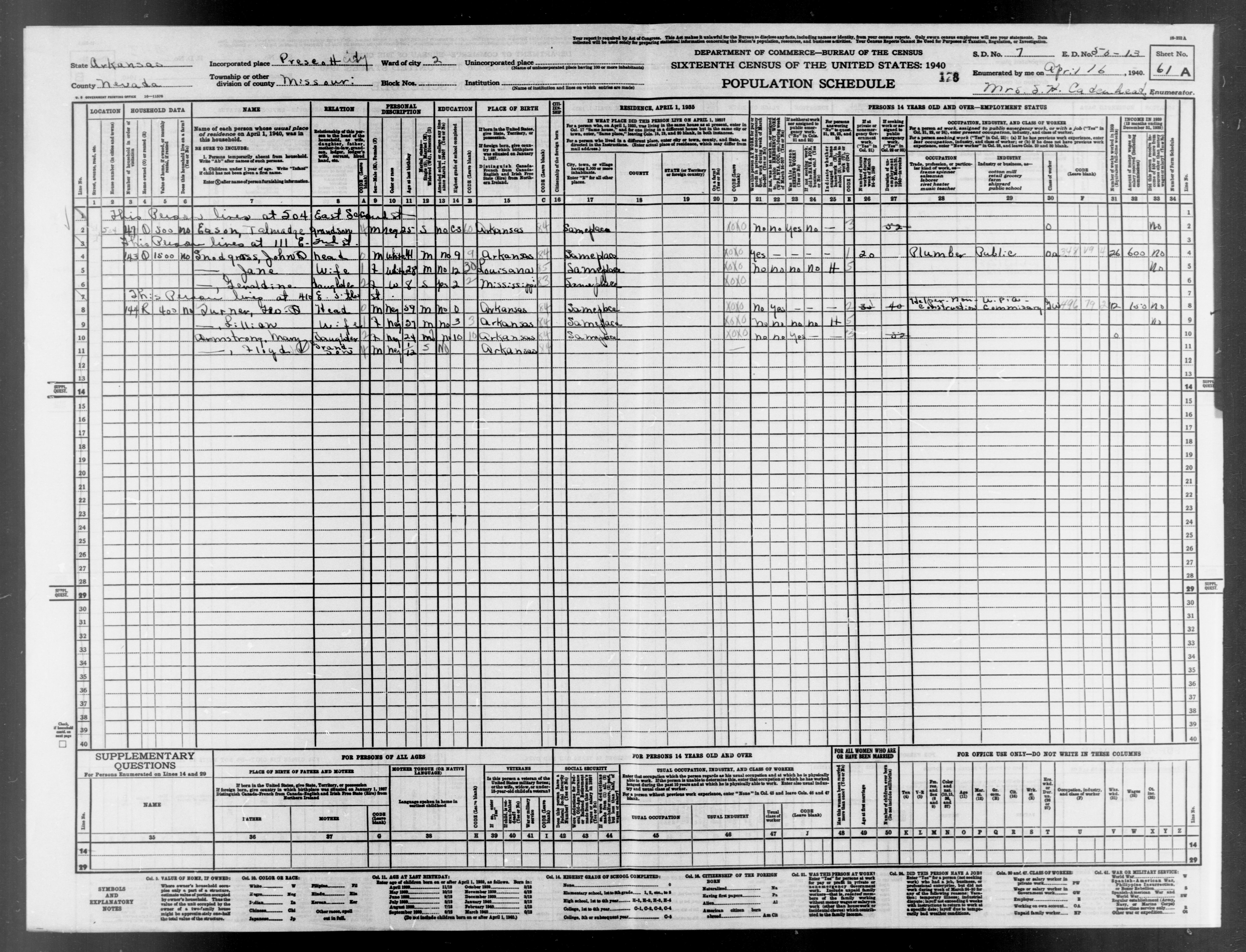
- Enumeration District 13 Prescott Ward 2
- Description: Arkansas Enumeration District 50-13 Prescott city - Ward 2
- Boundaries: Bounded by City limits, City limits, E. Main, Mo. Pac. R.R.
- Enumerated in 1940 by: Mrs S H Cadenhead
- 1940 Population: 490, 1930 Population: 504, 1930 Farms: 0
- Images: 1 2 3 4 5 6 7 8 9 10 11 12 13 14 15 16 17 18
- Index Compiled By: Julie Lofurno.
- Boundaries: Bounded by City limits, City limits, E. Main, Mo. Pac. R.R.
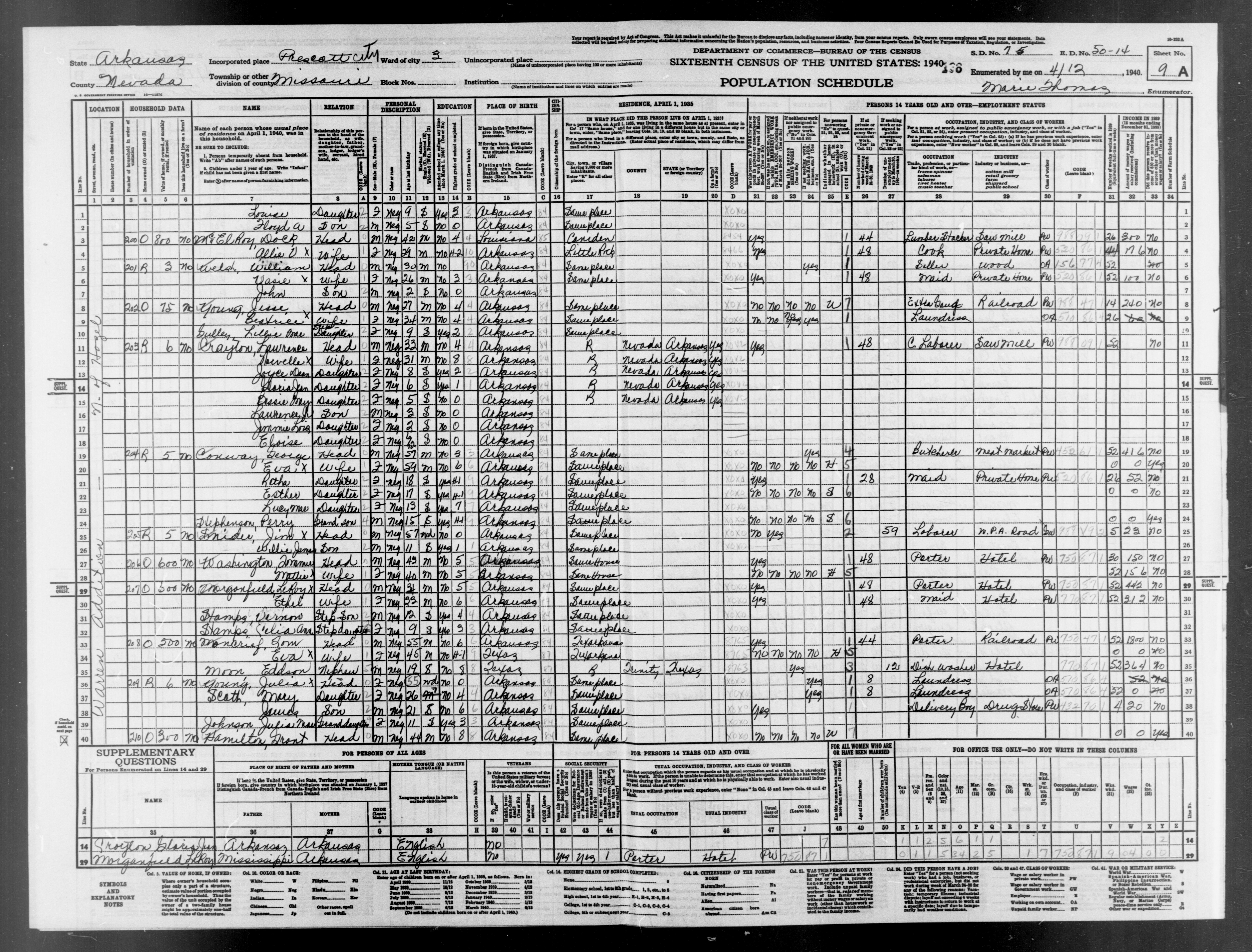
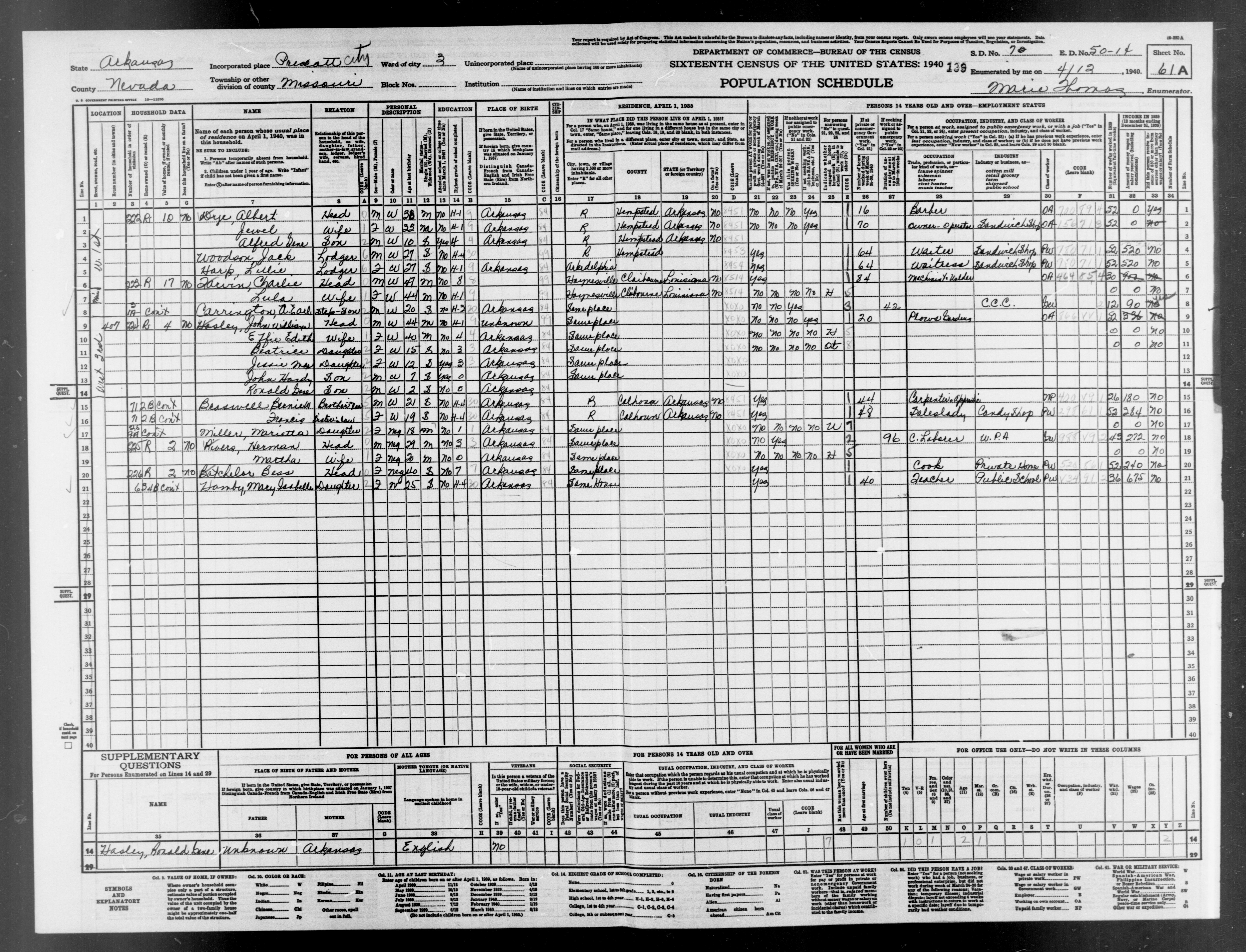
- Enumeration District 14 Prescott Ward 3
- Description: Arkansas Enumeration District 50-14 Prescott city - Ward 3
- Boundaries: Bounded by City Limits, Mo. Pac. R.R., W. Main, W. Main.
- Enumerated in 1940 by: Marie Thomas
- 1940 Population: 748, 1930 Population: 656, 1930 Farms: 0
- Images: 1 2 3 4 5 6 7 8 9 10 11 12 13 14 15 16 17 18 19 20 21 22
- Index Compiled By: Kathy Bobo.
- Boundaries: Bounded by City Limits, Mo. Pac. R.R., W. Main, W. Main.
- Enumeration District 15 Prescott Ward 4
- Description: Arkansas Enumeration District 50-15 Prescott city - Ward 4
- Boundaries: Bounded by City limits, W. Main, Mo. Pac. R.R., City limits, City limits. Show separately Prescott City Jail.
- Enumerated in 1940 by: Jesse Thomas Davis
- 1940 Population: 1260, 1930 Population: 1171, 1930 Farms: 0
- Images: 1 2 3 4 5 6 7 8 9 10 11 12 13 14 15 16 17 18 19 20 21 22 23 24 25 26 27 28 29 30 31 32 33 34
- Index Compiled By: Kathy Bobo.
- Boundaries: Bounded by City limits, W. Main, Mo. Pac. R.R., City limits, City limits. Show separately Prescott City Jail.
- Enumeration District 16 Missouri Township SouthE
- Description: Arkansas Enumeration District 50-16 Missouri township
- Boundaries: That part southeast of Mo. Pac. R.R., outside Prescott city. Show separately Nevada County Poor Farm.
- Enumerated in 1940 by: Alvis Earl Bomar
- 1940 Population: 1485, 1930 Population: 1550, 1930 Farms: 259
- Images: 1 2 3 4 5 6 7 8 9 10 11 12 13 14 15 16 17 18 19 20 21 22 23 24 25 26 27 28 29 30 31 32 33 34 35 36 37 38 39 40 41 42
- Index Compiled By: Jerry McKelvy.
- Boundaries: That part southeast of Mo. Pac. R.R., outside Prescott city. Show separately Nevada County Poor Farm.
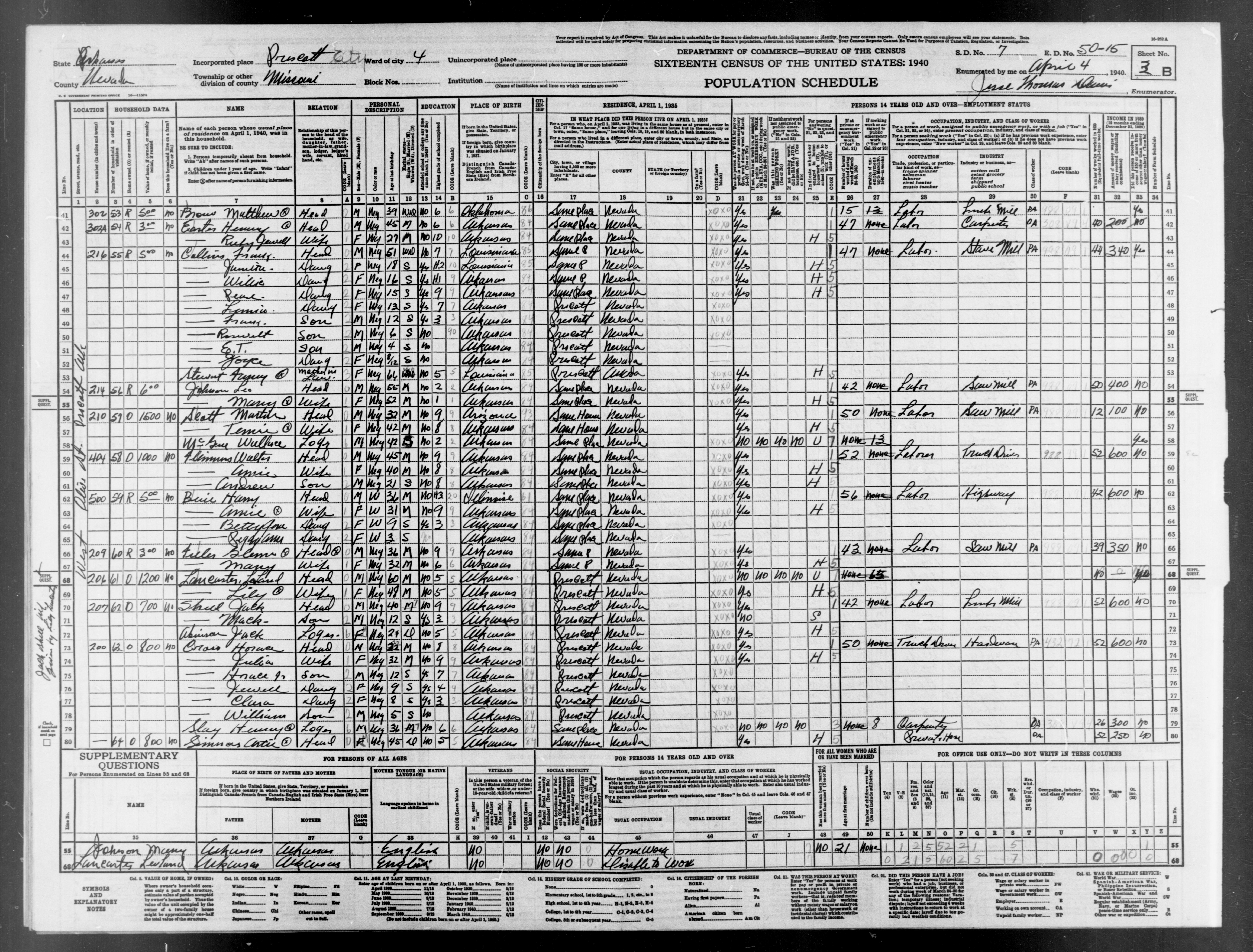
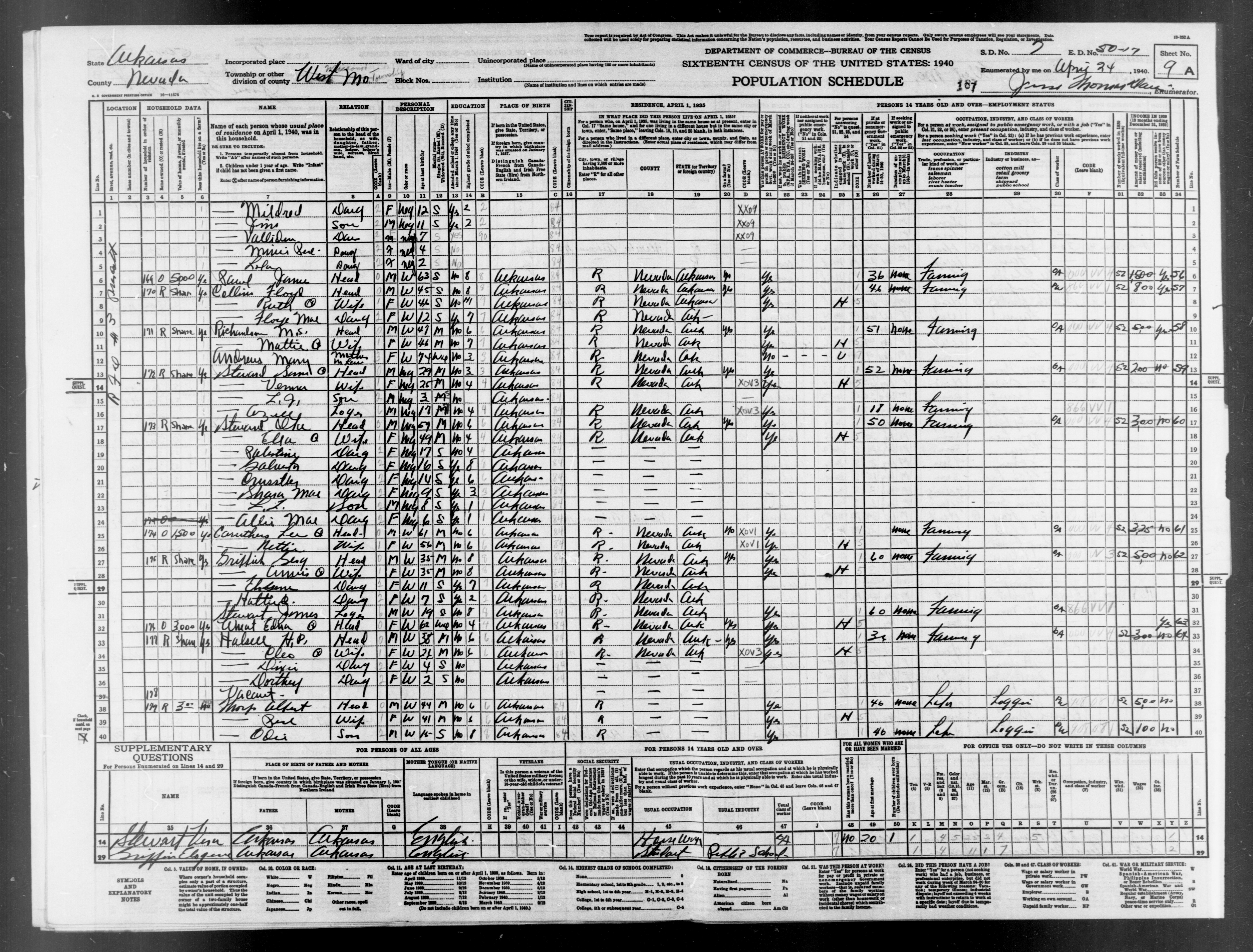
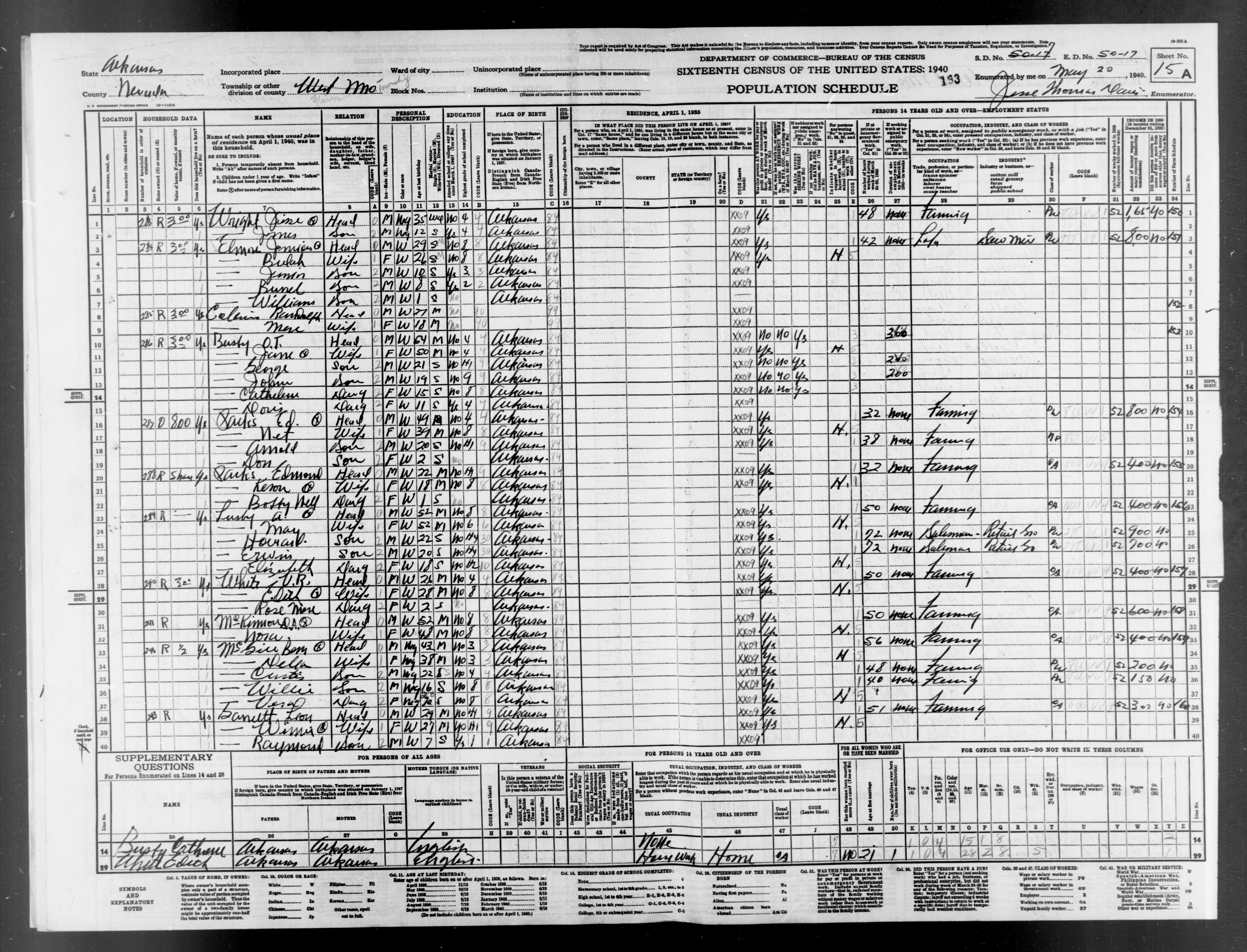
- Enumeration District 17 Missouri Township NorthW
- Description: Arkansas Enumeration District 50-17 Missouri township
- Boundaries: That part northwest of Mo. Pac. R.R., outside Prescott city.
- Enumerated in 1940 by: James W Barlow and James Thomas Davis
- 1940 Population: 1526, 1930 Population: 1231, 1930 Farms: 179
- Images: 1 2 3 4 5 6 7 8 9 10 11 12 13 14 15 16 17 18 19 20 21 22 23 24 25 26 27 28 29 30 31 32 33 34 35 36 37 38 39 40
- Index Compiled By: Julie Lofurno.
- Boundaries: That part northwest of Mo. Pac. R.R., outside Prescott city.
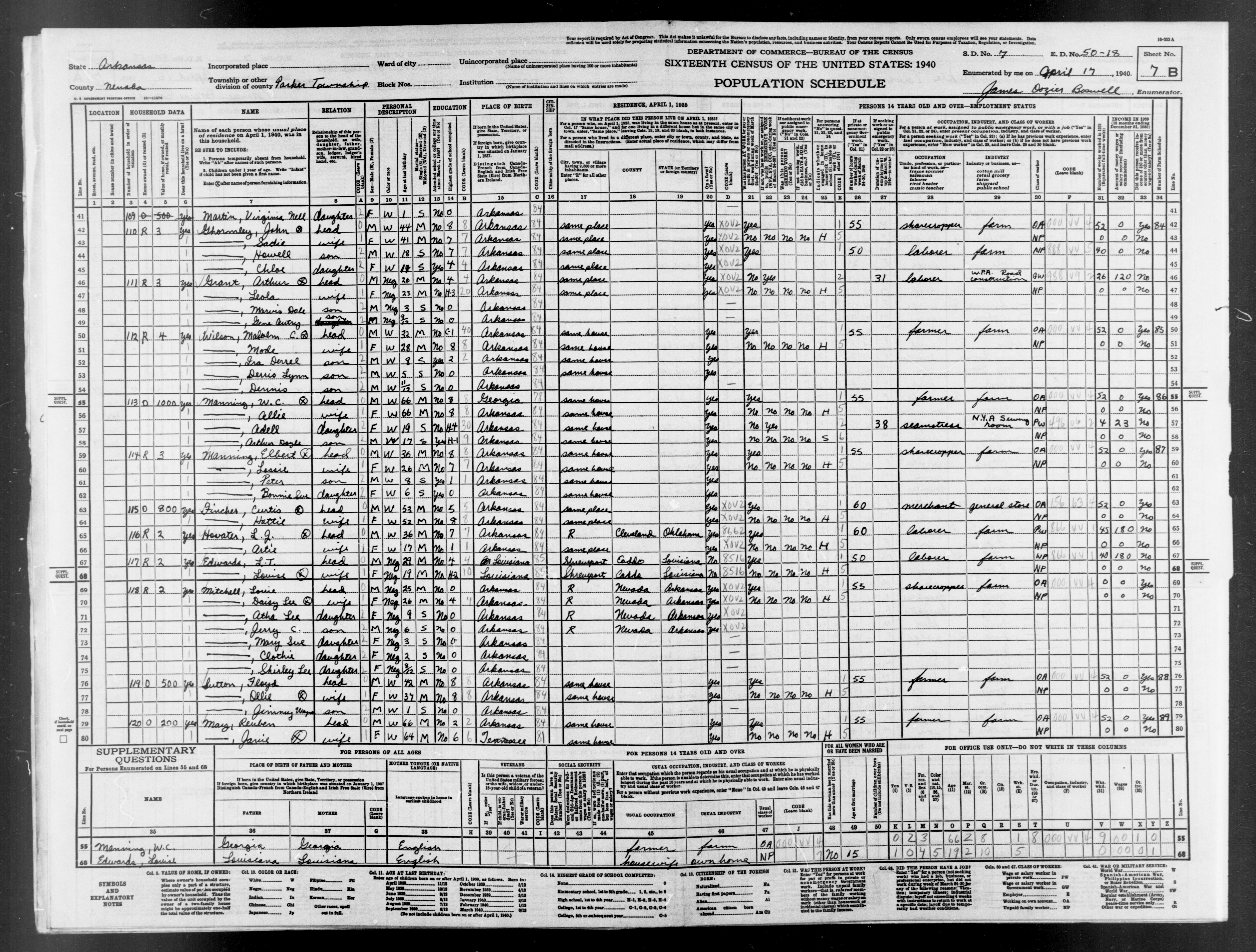
- Enumeration District 18 Parker Township North
- Description: Arkansas Enumeration District 50-18 Parker township
- Boundaries: That part north of the township line between Townships 13 and 14, Ranges 22 and 23.
- Enumerated in 1940 by: James Dozier Boswell
- 1940 Population: 735, 1930 Population: 764, 1930 Farms: 209
- Images: 1 2 3 4 5 6 7 8 9 10 11 12 13 14 15 16 17 18 19 20
- Index Compiled By: Jerry McKelvy.
- Boundaries: That part north of the township line between Townships 13 and 14, Ranges 22 and 23.
- Enumeration District 19 Parker Township South
- Description: Arkansas Enumeration District 50-19 Parker township
- Boundaries: That part south of the township line between Townships 13 and 14, Ranges 22 and 23. Show separately Bodcaw (unincorporated).
- Enumerated in 1940 by: Melba F Munn
- 1940 Population: 749, 1930 Population: 851, 1930 Farms: 170
- Images: 1 2 3 4 5 6 7 8 9 10 11 12 13 14 15 16 17 18 19 20 21 22
- Index Compiled By: Jerry McKelvy.
- Boundaries: That part south of the township line between Townships 13 and 14, Ranges 22 and 23. Show separately Bodcaw (unincorporated).
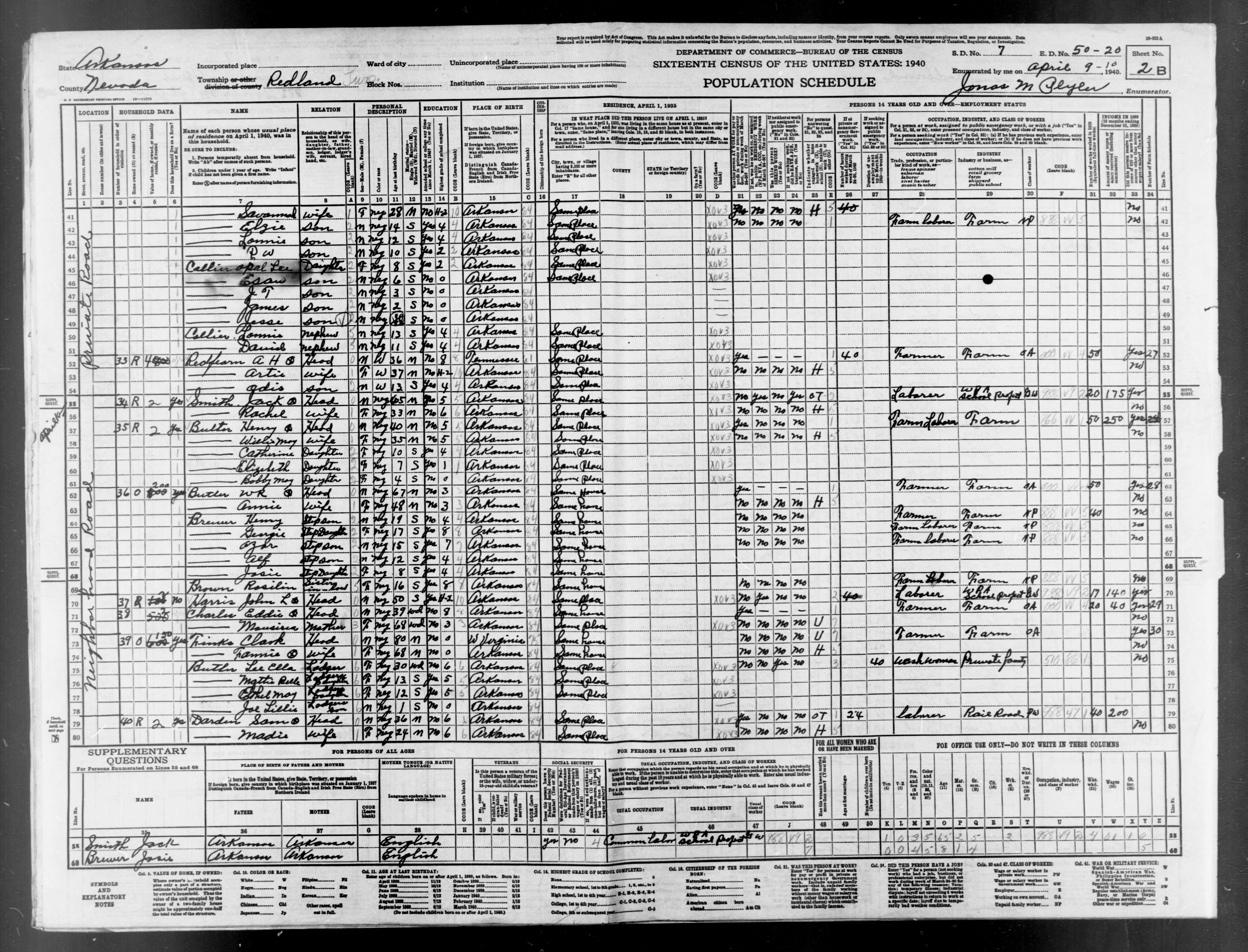
- Enumeration District 20 Redland Township
- Description: Arkansas Enumeration District 50-20 Redland township.
- Enumerated in 1940 by: Jonas M Plyler
- 1940 Population: 1129, 1930 Population: 1126, 1930 Farms: 225
- Images: 1 2 3 4 5 6 7 8 9 10 11 12 13 14 15 16 17 18 19 20 21 22 23 24 25 26 27 28 29 30
- Index Compiled By: Cathy Straley.
- Enumerated in 1940 by: Jonas M Plyler
- Enumeration District 21 Taylor Township East
- Description: Arkansas Enumeration District 50-21 Taylor township
- Boundaries: That part east of the section line from the northwest corner of section 3, Township 14, Range 21 to the southwest corner of section 10, Township 14, Range 21. Show separately Waterloo (unincorporated).
- Enumerated in 1940 by: Arna May Weems
- 1940 Population: 975, 1930 Population: 1049, 1930 Farms: 175
- Images: 1 2 3 4 5 6 7 8 9 10 11 12 13 14 15 16 17 18 19 20 21 22 23 24 25 26
- Index Compiled By: Jerry McKelvy.
- Boundaries: That part east of the section line from the northwest corner of section 3, Township 14, Range 21 to the southwest corner of section 10, Township 14, Range 21. Show separately Waterloo (unincorporated).
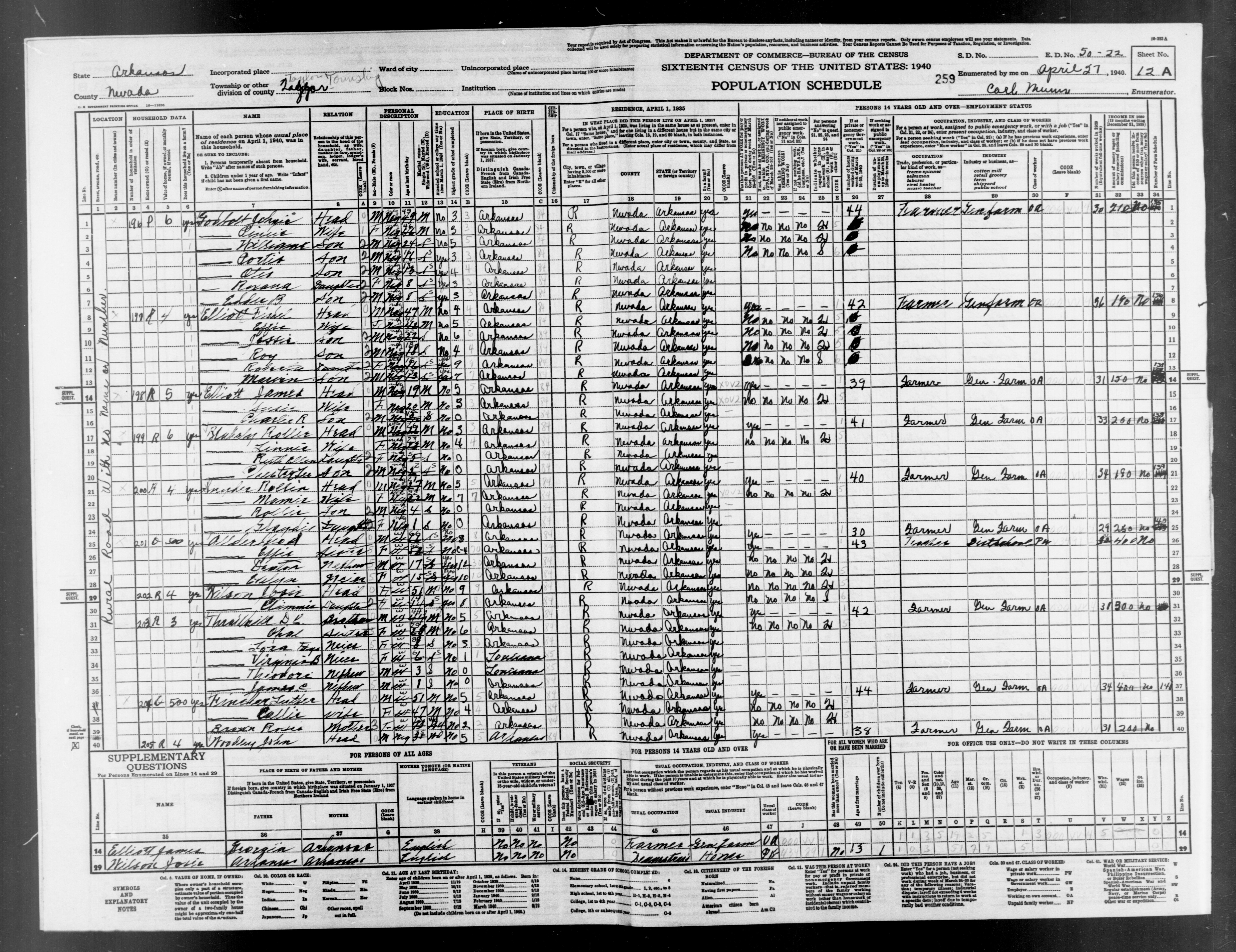
- Enumeration District 22 Taylor Township West
- Description: Arkansas Enumeration District 50-22 Taylor township
- Boundaries: That part west of the section line from the northwest corner of section 3, Township 14, Range 21 to the southwest corner of section 10, Township 15, Range 21. NOTE: Census said population was 1236. Indexing shows 1237.
- Enumerated in 1940 by: Carl Munn
- 1940 Population: 1236, 1930 Population: 1139, 1930 Farms: 222
- Images: 1 2 3 4 5 6 7 8 9 10 11 12 13 14 15 16 17 18 19 20 21 22 23 24 25 26 27 28 29 30 31 32 33 34
- Index Compiled By: Barbara Woelzlein.
- Boundaries: That part west of the section line from the northwest corner of section 3, Township 14, Range 21 to the southwest corner of section 10, Township 15, Range 21. NOTE: Census said population was 1236. Indexing shows 1237.
- Enumeration District 23 Union Township
- Description: Arkansas Enumeration District 50-23 Union township
- Boundaries: Show separately Bluff city (unincorporated), Theo (unincorporated).
- Enumerated in 1940 by: Mrs Olive Harvey
- 1940 Population: 1000, 1930 Population: 1150, 1930 Farms: 159
- Images: 1 2 3 4 5 6 7 8 9 10 11 12 13 14 15 16 17 18 19 20 21 22 23 24 25 26 27 28
- Index Compiled By: Jerry McKelvy.
- Boundaries: Show separately Bluff city (unincorporated), Theo (unincorporated).